![]() This post was written by Jeanine Finn (Claremont Colleges Library), as part of Practitioner Perspectives: Developing, Adapting, and Contextualizing the #DLFteach Toolkit, a blog series from DLF’s Digital Library Pedagogy group highlighting the experiences of digital librarians and archivists who utilize the #DLFteach Toolkit and are new to teaching and/or digital tools.
This post was written by Jeanine Finn (Claremont Colleges Library), as part of Practitioner Perspectives: Developing, Adapting, and Contextualizing the #DLFteach Toolkit, a blog series from DLF’s Digital Library Pedagogy group highlighting the experiences of digital librarians and archivists who utilize the #DLFteach Toolkit and are new to teaching and/or digital tools.
The Digital Library Pedagogy working group, also known as #DLFteach, is a grassroots community of practice, empowering digital library practitioners to see themselves as teachers and equip teaching librarians to engage learners in how digital library technologies shape our knowledge infrastructure. The group is open to anyone interested in learning about or collaborating on digital library pedagogy. Join our Google Group to get involved.
See the original lesson plan in the #DLFteach Toolkit.
Our original activity was designed around using a live GoogleSheet in coordination with ArcGIS Online to collaboratively map historic locations for an in-class lesson to introduce students to geospatial analysis concepts. In our example, a history instructor had identified a list of cholera outbreaks with place names from 18th-century colonial reports.
In the original activity, students were co-located in a library classroom, reviewing the historic cholera data in groups. A Google Sheet was created and shared with everyone in the class for students to enter “tidied” data from the historic texts collaboratively. The students then worked with a live link from Google Sheets, allowing the outbreak locations to be served directly to the ArcGIS Online map. It was successful and a useful tool for encouraging engagement and for getting familiar with GIS.
Then COVID-19 in 2020 arrived. Instead of a centuries-distant disease outbreak, students learning digital mapping this past year were thrust into socially-distant instructional settings driven by a contemporary pandemic that radically altered their modes of learning. The collaborative affordances of tools like ArcGIS Online were pressed into service to help students collaborate effectively and meaningfully in real-time while learning from home.
As an example, one geology professor at Pomona College encouraged her students to explore the geology of their local environment. Building on shared readings and lectures on geologic history and rock formations, students were encouraged to research the history of the land around them, and include photographs, observations, and other details to enrich the ArcGIS StoryMap. The final map included photographs and geology facts from students’ home locations around the world.
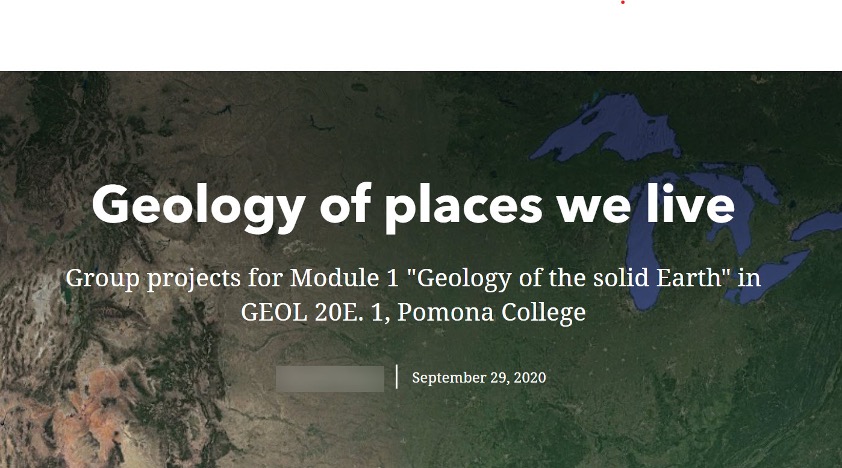 Header for Geology class group StoryMap at Pomona College, Fall 2020
A key feature of the ArcGIS StoryMap platform that appealed to the instructor was the ability for the students to work collaboratively on the platform itself — not across shared files on folders on Box, GSuite, the LMS, etc. While this functioned reasonably well, there were several roadblocks to effective collaboration that we encountered along the way. Most of the challenges related to permissions settings related to ArcGIS Online administration, as the “shared update” features are not set as default permissions. Other challenges included file size limitations for images the students wished to upload, the inability of more than one user to edit the same file simultaneously, and potential security issues (including firewalls) in nations with more restrictive internet laws.
Reflecting on these uses of StoryMaps over this past semester, we encourage instructors and library staff interested in to:
- Review user license permissions and best practices for ArcGIS StoryMap collaboration from Esri (some links below).
- Plan ahead to help students with collecting appropriate images, including discussions of file size and copyright.
- Encourage the instructor to coordinate student groups with defined roles and responsibilities to lessen the likelihood of multiple editors working on the same StoryMap at once (which can cause corruption of the files.
- Get clarity from IT and other support staff as needed to determine if students are working remotely from countries that may have restrictions on internet use.
Resources:
Participatory Mapping with Google Forms, Google Sheets, and ArcGIS Online (Esri community education blog): https://community.esri.com/t5/education-blog/participatory-mapping-with-google-forms-google-sheets-and-arcgis/ba-p/883782
Optimize group settings to share stories like never before (Esri ArcGIS blog): https://www.esri.com/arcgis-blog/products/story-maps/constituent-engagement/optimize-group-settings-to-share-stories-like-never-before/
Teach with Story Maps: Announcing the Story Maps Curriculum Portal (University of Minnesota, U-Spatial: https://research.umn.edu/units/uspatial/news/teach-story-maps-announcing-story-maps-curriculum-portal
Getting Started with ArcGIS StoryMaps (Esri): https://storymaps.arcgis.com/stories/cea22a609a1d4cccb8d54c650b595bc4
VI Conclusion recommendations
Gather materials ahead of time. Photographs from digital archives, maps
There may be data cleaning issues.