We’d like to welcome the 2016 Forum’s lanyard sponsor, Adam Matthew, to share an exciting project of theirs!
The battle at a small Pennsylvanian town called Gettysburg that began on 1 July 1863 and finished three days later is now considered the American Civil War’s most renowned clash. It was certainly one of the bloodiest, with almost 50,000 of the battle’s 170,000 participants becoming casualties. Of these 7,000 lost their lives over those days. The result was a victory for the Union forces over the Confederacy’s heretofore-and-improbably-invincible Army of Northern Virginia and, coupled with the surrender of Confederate Vicksburg far away on the Mississippi on 4 July, a turning point in this bruising war that culminated in the reunion and reconstruction of the United States in 1865.
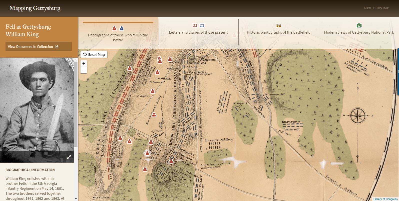
Mapping Gettysburg, a part of American History, 1493-1945 from the Gilder Lehrman Institute of American History, New York engages with the experiences of those who fought at Gettysburg by situating historic source material on an interactive map of the battlefield. It contains three main elements: letters and diaries recounting some of the action, portrait photographs of men who fell during the battle and historic photographs of the battlefield juxtaposed with modern views of the site as it is today, preserved as a National Park.
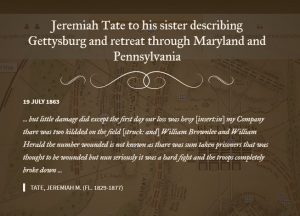 Eye witnesses: For example, at the site of Pickett’s doomed charge you can read David V. Smith of the 12th New Jersey Volunteers give his account of facing the final Confederate assault: “But I hope that we shall never get into another fight like that at Gettysburg Pa for it was awful beyond Discription I cannot discribe it with my pencil but if I do not get to come home myself this fall I will try to give you or Charley a slight sketch of it but I think you would not care to Read the details of the fight as it was. I will just say I sit on my knees by the side of Stone fence & loaded & fired my gun until I had blisters on my fingers as big as 10 cent peaces from Ramming down the loads & my gun was so hot I could not touch the Barrel with my hands & so was most the other I never wanted to load & shoot so fast in all my life before.”
The fallen: You can come face to face with some of the battle’s many dead or wounded; for example see the portrait of William King of the 8th Georgia Infantry and read about him and his brother’s exploits on 2 July in the infamous Wheatfield.
Photographs: Then you can pan around the map to see historic photographs of the battlefield – for example, see modern and old views of another of the battle’s famous episodes in the form of Little Round Top, the site where the Union forces only just stopped the Confederates turning their flank.
What’s more, the map connects you to images of the original documents and additional primary source material relating to the men who fought. This allows you to follow their lives pre- and post-Gettysburg, making this map a starting point to then delve back into the collections of American History, 1493-1945 and thus examine the thoughts, concerns and motivations of the men who fought at this most terrible yet iconic American Civil War battle.
Mapping Gettysburg can be accessed within American History, 1493-1945. To explore the interactive features in more detail, request free 30-day trial access by contacting trials@amdigital.co.uk with ‘DLF Blog’ in the subject line.